Nearly forty years ago, I was working with NASA on one of the early efforts to use LandSat imagery to study natural systems; specifically, we were attempting to assess biomass production of large boreal forest regions. That work met with only partial success, but I did discover something that’s been very important to me ever since. From the air, even with just the ‘naked eye’, it’s possible to see patterns and phenomena from that can be very difficult to pick up on the ground.
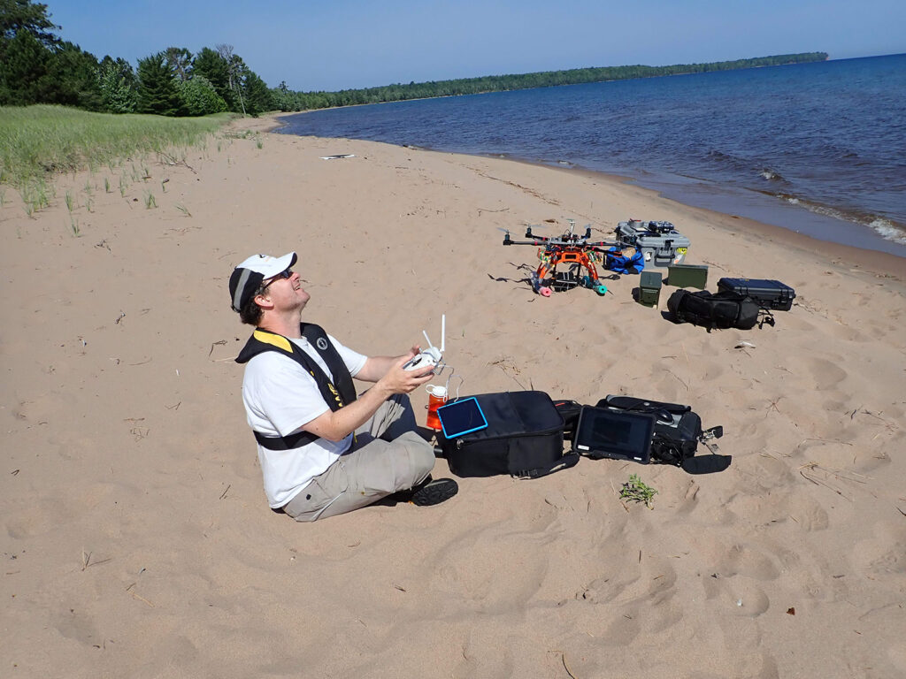
Since then, remote-sensing tools have increased dramatically in sophistication and power. In the last few years, the advent of small “Unmanned Aerial Vehicles” — drones — that can carry a wide array of sensors, has dramatically increased accessibility of remote-sensing tools for field-based research. During the 2019 field season, HMWF sponsored three projects involving drones; one addressed three-dimensional structure of forest canopies, one used drones in surveys of aquatic plant distribution at Howe Lake, and a third used both aerial and underwater drones to study sediment transport in the Salmon Trout River.
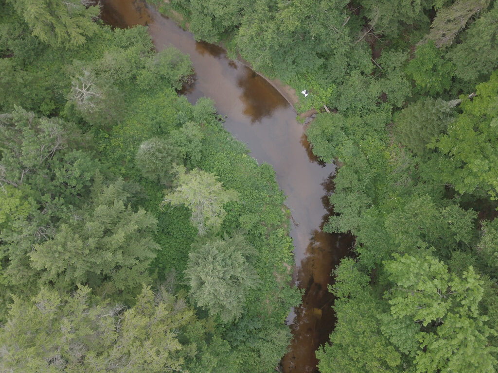
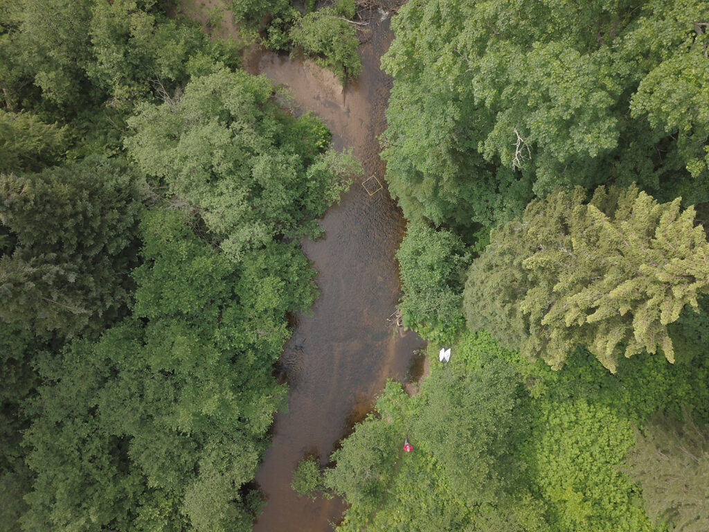
This last project, involving a team of researchers from Michigan Technological University, led by Dr. Amy Marcarelli, explores the potential for drones to track sediment properties and movements in the channel of the Salmon Trouth, and to study the ‘plume’ of sediments entering Lake Superior from the river mouth.
Only early results are available, but these are visually exciting and quite promising regarding the utility of the approach. For example, it’s clearly possible to distinguish sediment types and stream-bed properties from the drone imagery. This means that important data about condition of ‘coaster’ brook trout spawning areas and movement of ‘pulses’ of fine sands intruding into the river bed can be tracked through a few 20-minute drone flights rather than many hours of laborious ‘direct’ surveys afoot.
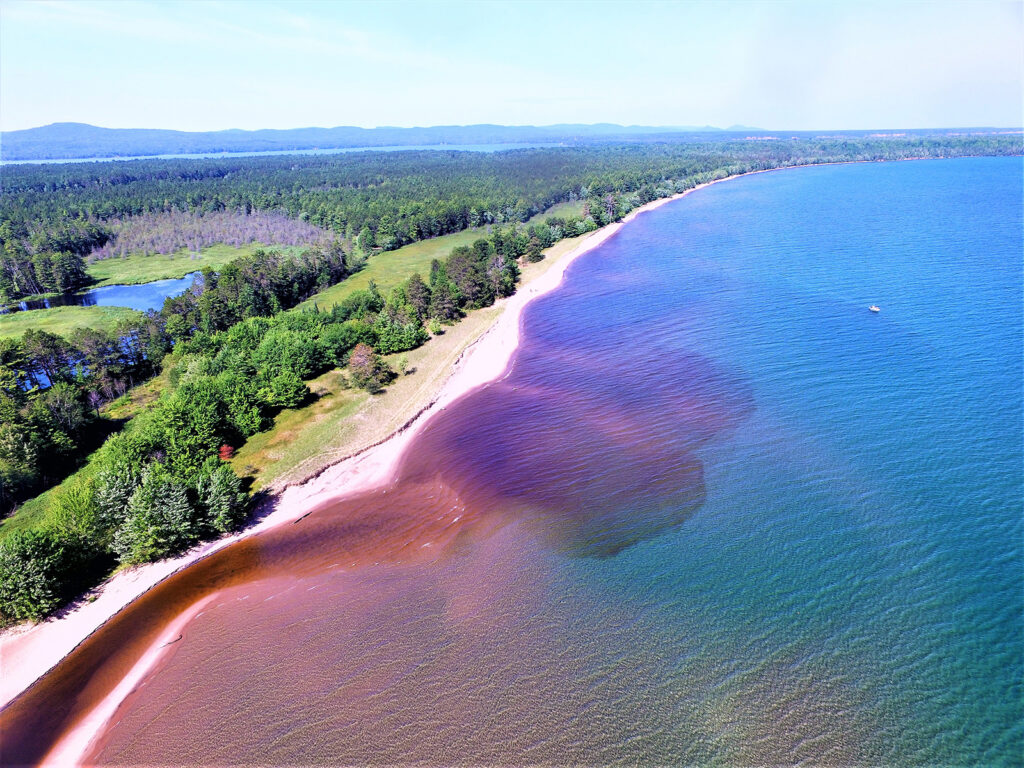
Boaters are already aware of the existence of visible ‘plumes’ of river water where streams enter Lake Superior. These plumes involve both suspended sediments and a variety of visible and invisible chemical differences. Marcarelli’s team designed their aerial drone work to coordinate with cruises by a tethered submersed vehicle — a submarine drone. One of their main questions was whether water and sediment properties that can be measured directly by the submarine drone, can be detected from images collected by the easier-to-operate and cheaper aerial drone.
One of the hallmarks of remote-sensing data collection, whether by satellite or drone, is that vast quantities of data can be collected in a short time. The processing and analysis of the resulting imagery is a much more complex and time-consuming process, however. Analysis of the data collected in a few days in 2019 is ongoing. (One side-effect of this new technology, not always welcome to those of us who prefer to spend time in the field, is that the ratio of time in the field to time in front of the computer, becomes progressively smaller!) But the striking patterns immediately visible in drone imagery from the mouth of the Salmon Trout suggest that it will be possible to extract a great deal of information about interactions between river and lake.